Parks and Trails collecting ideas for countywide non-motorized master plan
Have you ever wished there was a pedestrian or bike trail near your house to help you commute safely to work or the store? If so, now is the time to let Missoula County know where trails are needed.
This week, the staff of Missoula County Parks and Trails held a series of public meetings to ask county residents about how they use existing pathways and trails, and where more are desired.
They’ll take all the public input they get between now and August 26 to develop a Pathways and Trails Master Plan for all of Missoula County. In the past, similar plans have only been created for the City of Missoula.
“This kind of planning has never been done. We as the county have been a little directionless,” said Juniper Davis, program director for Missoula County Parks, Trails and Open Space. “We want to get people excited about what trails could be. We need ideas. Then we hopefully get some funding.”
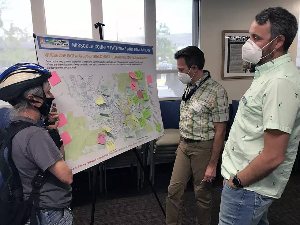
After holding meetings in Lolo, Milltown and Frenchtown, Parks and Trails staff talked to Missoulians on Wednesday afternoon at the Sophie Moiese Room of the Missoula County Courthouse.
Large maps of Missoula, Lolo, the Potomac area, Seeley Lake and Frenchtown were spaced throughout the room and people were asked to place sticky notes next to areas of concern describing problems or where trails were needed.
Talking with Stephen McDaniel of WGM Group and Missoula County Parks and Trails employee Travis Ross, Missoula bicycle rider Vicki Watson got deep into all the possibilities she like to see around Missoula, including a path from the end of the Kim Williams Trail to Milltown State Park and a connection from the west end of the Milwaukee Trail across Mullen Road to provide access farther west.
“This is my dream: It would be nice if you could bike all the way from Milltown to Grant Creek without getting on a road,” Watson said.
This is pie-in-the-sky planning. Just throw ideas out there and don’t let money be an obstacle. With the population growth occurring in the county, it’s good to at least plan where trails might go before other things are built in the way. Once everything fills in, it will be harder to put trails and pathways through.
Naturally, the Missoula area map acquired the most sticky notes on Wednesday. One said, “Fort Missoula – large recreation destination. Hard to access on bike or walking.” Another pointed to the Kim Williams Trail east of the University of Montana saying, “Smoother base on the Kim Williams Trail would make commuting more attractive.”
But Davis said she got useful information from the previous meetings in other towns too.
“It’s interesting to see who turns out in rural communities. Often, it’s parents of school children and retirees who want safer routes to walk. Meetings in rural communities have been insightful,” Davis said.
For those who weren’t able to attend one of the public meetings, it isn’t too late to brainstorm with the county. Parks, Trails and Open Space has created a special website with an online survey and separate pages to explain the planning process.
Once the comments are in on August 26, staff will start mapping out the suggestions and putting the plan together. The goal is to have it complete by the end of May.
“That’s just one year. It’s ambitious, but we’re committed,” Davis said.
The Missoula City-County Metropolitan Planning provided almost two-thirds of the funding for the planning process and the other third came from state Community Planning Block Grants. That left the county to provide a small match, Davis said.
Contact reporter Laura Lundquist at lundquist@missoulacurrent.com.