Heavy rains leave Clark Fork running rusty, muddy through Missoula
Recent heavy rains have caused the Blackfoot and Clark Fork rivers to look more like muddy streams in spring than in September.
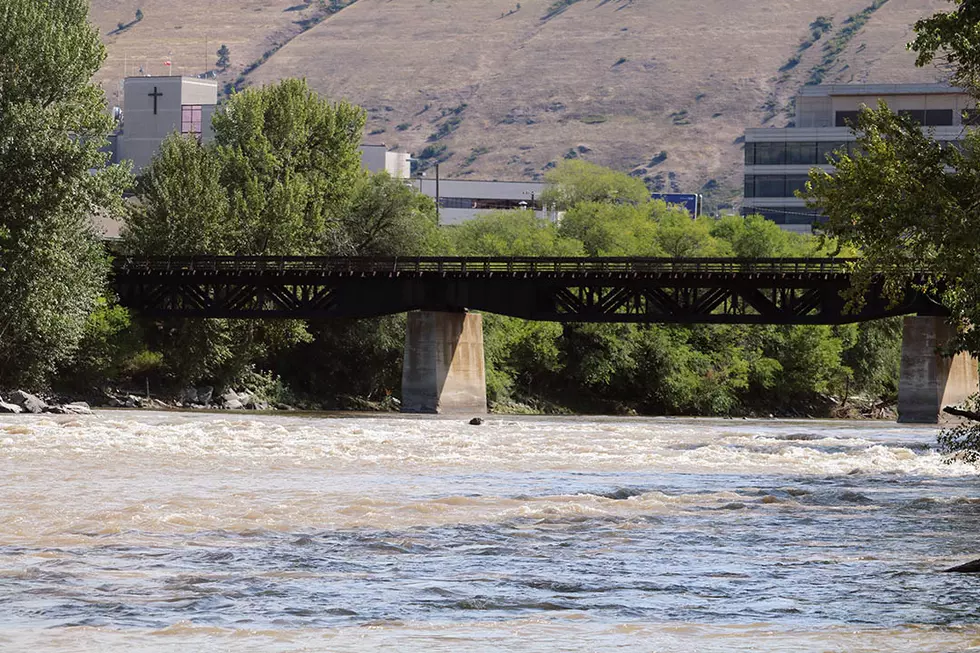
On Tuesday and Wednesday, the Clark Fork River had a rusty, muddy appearance as it flowed through Missoula, and the majority of the mud appears to have come from the Blackfoot Valley. The Blackfoot River, its pools normally a clear dark green this time of year, was also a muddy mixture as it flowed into the Clark Fork near Bonner.
Lolo National Forest Public Affairs Officer Kate Jerman said Forest Service employees still aren't sure about the cause of the mud, and it could be the result of a number of factors. No one is certain yet where the mud is entering the Blackfoot.
One source could be Yellowjacket Creek, which flows into Monture Creek, a tributary of the Blackfoot River. A USFS crew reported that the Monture Trail washed out into Yellowjacket Creek, Jerman said. However, a landslide-type event probably would produce a pulse of sediment and not a continuous release. The Lolo Forest sent a crew back in to assess the site.
The Blackfoot River was flowing at just below average until Sunday, when it grew about 40 percent as a result of the rains, according to the U.S. Geological Survey.
Jerman said rainstorms that kicked in over the weekend may have stirred up sediment deposited by a landslide in July or high flows could have cut into already eroded banks of the Blackfoot River. The landslide occurred in areas burned in the 2017 Rice Ridge Fire, but the sediment released never made it to the Clark Fork River.
“Good news (is), at this time, we do not have debris flows over roads that we are aware of,” Jerman wrote in an email. “We are closely monitoring the Lodgepole drainage along with the adjacent Spruce Creek - where the slide occurred in July - and Dunham Creek drainages. All of these drainages look okay for the time being.”
Jerman said the Lolo National Forest will provide updates as information becomes available.
The Clark Fork River also swelled due to the weekend rains and was still flowing at 200 percent of normal for mid-September near Turah on Wednesday. Below the confluence of the Clark Fork and Blackfoot rivers, it’s at 160 percent of normal.
John DeArment, Clark Fork Coalition science director, was sampling water quality in the Clark Fork River on Tuesday and said the clarity was about five or six times worse than it normally is in Septembery.
DeArment said the Clark Fork could have contributed some of the sediment, but probably not enough to account for the noticeable color change in the river. So the Blackfoot is still the primary source.
“It’s the same processes. We get a big rain and things that can move have a way of doing that in the water,” DeArment said. “How we treat the landscape comes back to haunt us in the rivers.”