Forest Service launches scoping for massive Bitterroot Front Project
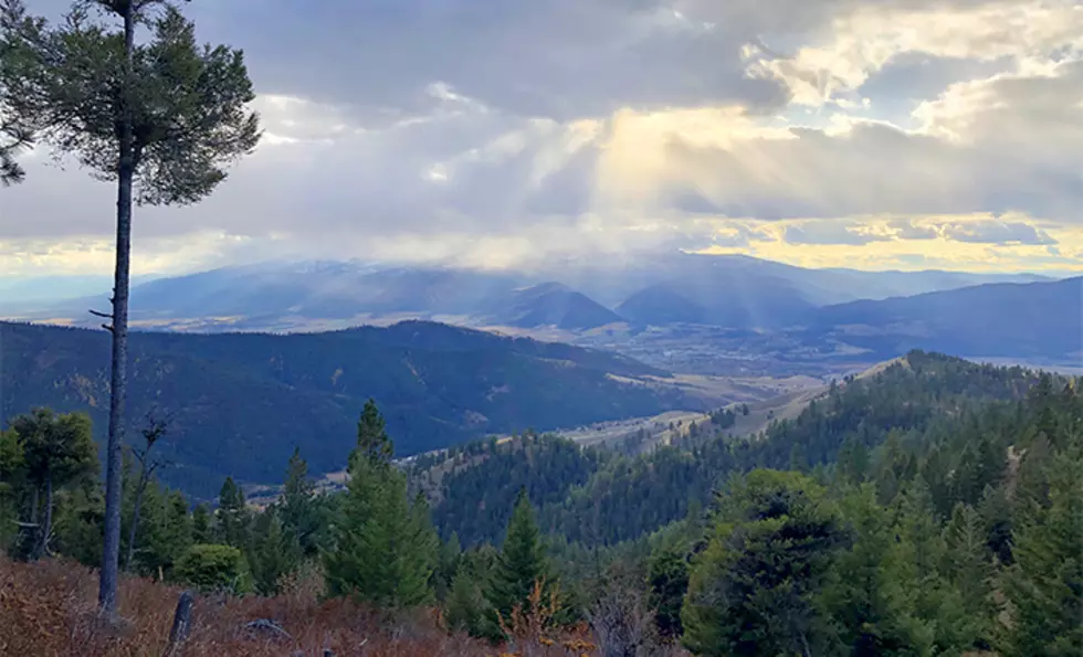
The U.S. Forest Service this week announced it was beginning scoping efforts on the proposed Bitterroot Front Project affecting forestlands from northwest of Florence south to Conner and Trapper Creek.
Since scoping is the first step in the public process, the documents consist of a series of maps showing areas where a group of agencies want the focus on timber, prescribed burns or other activities. The agencies include the Confederated Salish and Kootenai Tribes, Ravalli County, Montana Department of Natural Resources and Conservation, and other federal agencies.
If the project sounds familiar, that’s because Bitterroot National Forest supervisor Matt Anderson held a series of “pre-scoping” meetings in 2019 to give the public more of a heads-up on the project. It led to some confusion as to what the public was to do, but Anderson told the Bitterroot Star in 2019 he just wanted to describe the “desired future condition that we want and then look at the various ways we can achieve it.”
The Forest Service describes the project as it does many others: a “fuels reduction, vegetation management, and forest health improvement project” that will provide timber projects and related jobs. Calling it “a landscape-scale proposal,” the Forest Service proposes a “Shared Stewardship Approach” to encourage vegetation treatments across ownership boundaries. Private landowners along the forest boundary will be invited to participate in the project through Bitter Root Resource Conservation and Development and Good Neighbor Authority.
The Bitterroot Community Wildfire Protection Plan identifies the project area as a ‘high priority’ for fuels reduction to reduce wildfire threats to lives, property and resources within the Wildland Urban Interface. The Bitterroot WUI already has a high density of residences, and more people keep moving in and expecting fire protection.
But often, it can be private landowners who want public forests to be managed but won’t take the same steps on their own property. They want the idyllic house or cabin hidden in the woods. And the more people who move in, the higher the risk of fire because humans now start most wildfires. So private landowners along the range might be the weakest link.
In a Forest Service video, Bitterroot landowner Judy Anderson talks about how expensive it can be to manage the trees on her property.
“Any resources we can get to protect people and property is worth it. But our neighbors have to do it too or it’s a moot point,” Anderson said.
Rancher Tom Ruffatto said he wants to work with agencies to do what he can but not everyone feels that way.
“It’s really tough when you have a checkerboard pattern of ownership, you have someone who does a really good job and their next-door neighbor does nothing. And they don’t want to do anything. So it’s just tough,” Ruffatto said.
When Anderson first revealed the Bitterroot Front Project in 2019, it was projected to be 150,000 acres. Now, the announcement puts the size at 144,000 acres. The Forest Service said the project area boundary still includes land outside the WUI to allow the opportunity to address other resource issues within the area including roads, recreation, and scenery.
In 2019, some were disappointed to see a timber emphasis put on wildlands beyond the WUI such as inventoried roadless areas or recommended wilderness areas. Along Lost Horse Creek, the project area extends all the way to the Bitterroot-Selway Wilderness boundary.
Several groups were also concerned that Anderson would use an abbreviated public process through the use of categorical exclusions. They worried that giving blanket approval to such a large project would jeopardize more localized values not addressed in the big project description.
They also point out that the project is being driven by a forest plan that is more than 30 years old. The Bitterroot National Forest won’t start rewriting its plan for another few years but such a large project could lock in a situation that wouldn’t necessarily pass muster under the upcoming new plan.
Finally they questioned Forest Service claims that the project would protect residents from large fires. In its video, the Forest Service used the example of the 2016 Roaring Lion Fire, which burned 8,000 acres and 16 homes within 24 hours.
However, wildfire studies show that logged and thinned areas don’t stop catastrophic wildfires such as the Roaring Lion or the Lolo Peak fires. Such fires erupt due to extremely hot, dry conditions and then are pushed along by high winds. The high winds not only make forests burn hotter but they also carry firebrands far from the active front of the fire so fires can spread quickly, leaping over thinned or logged areas.
In such conditions, even trees aren’t necessary, as evidenced by all the damage caused by the destructive grassfires of eastern Montana.
Logging and prescribed burns can diminish the damage and progress of normal forest fires that pop up during more normal conditions. However, those are also the kind of fires that firefighters are very effective at controlling, so they’re not as much of a threat, said retired U.S. Forest Service fire behaviorist Jack Cohen.
Cohen cautions those who would use catastrophic fires as a justification for forest projects and who promise such projects will protect residents.
“We’re already successful at stopping 95-98% of wildfires. If we’re not doing preparatory projects to handle the 3% of the fires that are causing us 80-95% of the problems, particularly in light of climate change, then don’t do it. Because it won’t work,” Cohen said. “That seems to be the hard sell.”
To learn more about the Bitterroot Front Project and to view maps visit www.fs.usda.gov/bitterroot. Click on ‘Land and Resource Management’, then ‘Projects’. Public comments specific to this project are valuable in helping the Forest Service identify potential issues and concerns. Comments are due by May 20, 2022.
Contact reporter Laura Lundquist at lundquist@missoulacurrent.com.