Montana snowpack recovers, thanks to cool April
April’s cool temperatures helped Montana’s mountains hold onto the moisture dropped by a few storms that brought most of the high-elevation snowpack up to about average. However, moisture is still lacking at mid- and low-level elevations, so a hot summer could once again parch Montana’s streams.
After a dismal April 1 water supply report showed snowpack almost statewide was at least 10% below average or worse, the U.S. Natural Resources Conservation Service’s May 1 report now shows most basins with 95% of their snowpack or better.
The northwest section of the state is doing the best with 110% of the 30-year-average or better. That’s a turn-around from the past few years when the Yaak was getting very little moisture. The northern Rocky Mountain Front is also flush with 120% of its snowpack.
However, mountains in the southwestern part of the state didn’t get enough snow to allow them to catch up after the weather in March put them at a significant deficit. The Beaverhead basin has just 89% while the Ruby and the upper Madison have around 80%. Bringing up the rear is the Sheilds River with only two-thirds of its normal snowpack.
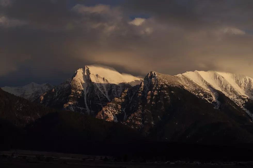
Around Missoula, the snowpack of the upper Clark Fork and Blackfoot basins is about average while the Bitterroot is doing a little better with 110%.
The month of April wasn’t that great as far as total precipitation, but the cool temperatures made up for it. According to data from the University of Idaho WestWide Drought Tracker, the average temperature for the month was at least 4 degrees colder than normal. In the far northeast section of the state, it was 9 degrees colder.
Although a few storms rolled through to add snow to the mountain passes, most of the northern mountains received only around 80% of their normal April precipitation. But the cold air helped them keep what snow they had. Farther south, the Bitterroot and Big Hole mountains benefitted more from the storms, receiving around 120% of their monthly precipitation.
The current snowpack bodes well for summer streamflows if the seasons play out the way they used to. But with one more month to go until summer, conditions could change quickly, leaving the state high and dry. On Monday, a Montana Trout Unlimited Facebook post warned against assuming we’re out of the woods:
“A word of caution: on June 1, 2021, the mountain snowpack was about average for that time of year. After two weeks of extreme, dry heat, on June 15, the snowpack was gone. Mountain snowpack is only a portion of the water availability puzzle. 100% snowpack does not necessarily translate to good flows throughout the summer. May and June's rains are critical to maintaining good summer streamflows.”
Like much of the West, Montana is still suffering from moderate to extreme drought, except in the northwest corner. And while the mountains still get snow, with climate change, the valleys tend to get a lot more rain, which doesn’t stick around, being rapidly absorbed by the parched earth.
The long-term weather outlook briefly favors the eastern side of the state. During May, there’s a good probability that the eastern half will see slightly cooler temperatures and more precipitation than the western half. But the three-month outlook brings bad news - all of Montana and almost all of the nation will likely see higher than normal temperatures. All but the northeastern portion of Montana is also predicted to be drier than normal.
If the National Oceanic and Atmospheric Administration predictions bear out, this summer could look very much like last summer. And Montana’s drought may deepen once again, leaving streams running low and setting the stage for a challenging wildfire season.
Contact reporter Laura Lundquist at lundquist@missoulacurrent.com.