Booming use prompts rewrite of Flathead River management plan
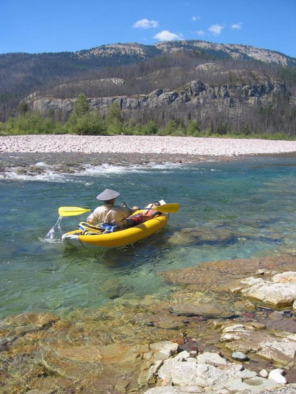
There’s a lot of rubber and plastic floating down the Middle Fork of the Flathead River on any given Saturday in the summer.
Same for the North Fork, and the South Fork.
People too.
The rubber and plastic comes in the form of kayaks and rafts, and they are coming by the thousands – with those people aboard – to experience one of the three forks of the Flathead River: the North Fork from Polebridge to Coram, the Middle Fork from Essex to West Glacier, and the South Fork down by Spotted Bear.
Increased use over the last 30 years has led the Flathead National Forest to update its river management plans for the three forks of the Flathead. The last plan dates to 1986.
“It’s long overdue,” Darwon Stoneman, co-owner of Glacier Raft Company, said. Stoneman and his former partners, Sally Thompson and Ono Wieringa, started the raft company in the 1970s.
“It’s about time,” Stoneman said. “Things have changed since 1986. It’s pretty crazy on the rivers, especially on the weekends. A lot of the accesses are overtaxed.”
The Flathead’s triple forks were designated a Wild and Scenic River in 1978.
Now the Flathead National Forest, in coordination Glacier National Park, has started the process to write a comprehensive river management plan for the river; a series of public meetings began in May.
The next session is set for June 20 at Flathead Valley Community College.
The plan will set direction for the river forks, which have various protections under the Wild and Scenic Rivers Act.
The planning effort is being coordinated by HydroSolutions, a Helena engineering and consulting firm. Work on the plan began in October 2017 and is scheduled for completion in 2020.
NORTH FORK OF THE FLATHEAD
The North Fork of the Flathead River is classified as a Scenic River for 40 miles from the Canadian border to the Camas Creek Bridge on the western border of Glacier National Park. From this point to the confluence with the Middle Fork at the Blankenship Bridge, the North Fork is a recreational river for 21.4 miles.
MIDDLE FORK OF THE FLATHEAD
The Middle Fork of the Flathead River is classified as Wild from its headwaters at the confluence of Strawberry and Bowl creeks in the Great Bear Wilderness near Schafer Meadows Ranger Station to Bear Creek near Essex. Of this 46.6-mile stretch, 13.5 miles are within the Bob Marshall Wilderness and 33.1 miles are in the Great Bear Wilderness. From Bear Creek to its confluence with the South Fork, a 54-mile segment, the Middle Fork is classified as a recreational river.
SOUTH FORK OF THE FLATHEAD
The South Fork of the Flathead is classified Wild for 51.3 miles from its headwaters at the confluence of Youngs and Danaher creeks in the Bob Marshall Wilderness to the Spotted Bear Ranger Station. From the ranger station to the upper end of the Hungry Horse Reservoir, 8.8 miles, the South Fork is a recreational river.
As a guide, one of the challenges that Stoneman sees with the planning process is the issue of how to limit river use.
He said the four river companies that operate on the Flathead contribute only a small portion of the overall use of the forks. In fact, on the North Fork of the Flathead, which sees about 40,000 river-user days annually, the three raft companies that have permits there contribute about 1,300 river-user days, he said.
“1,300 is not a big number,” he said. “We get blamed for being part of the problem, but I don’t think we are.”
“There’s a lot of problems in setting limits,” he said. “For outfitters, yes, but it’s hard to limit the general public. It would be hard to control the reduction of use, or limits of use.”
Stoneman said weekends are typically the busiest days of the summer, with hordes of floaters arriving at the overtaxed put-ins and take-outs on the Middle Fork.
While outfitter use has remained stable, private floater use has increased dramatically, Stoneman said. “The private use is what has gone up.”
The North Fork, with its easier whitewater and abundant scenery, tends to see more use, according to Stoneman. In 1986, the last time a river management plan was drafted for the three forks, the river traffic was less than 10 percent of what it is now.
Stoneman said the river-use planning process, if it’s anything like the Flathead Forest planning process, is “arduous. “The river plan might not be as bad,” he said, “but it’s a government process.”
Still, he’s seen how the river corridor use has changed on the Middle Fork near West Glacier, and not just by river rats. He says the hundreds of rail cars filled with oil that roll down the Middle Fork of the Flathead River corridor every day pose a greater threat to the river than the river users.
In fact, he has purchased business interruption insurance, should a train derailment shut down the Middle Fork river corridor.
“It’s not a question of if, it’s when,” he said. “We’re not going to get them to quit running, but they need stronger cars, and we need to force them to build stronger cars. There’s just too much potential for something to happen.
“The Forest Service doesn’t seem to want to take that battle on. They’re avoiding the oil train issue.”
The June 20 meeting will focus on wildlife monitoring and management. The meeting will be in the Arts and Technology Building at Flathead Valley Community College and starts at 5:45 p.m.
Updates on the plan process can be found by following this link.