Viewpoint: Make Lolo National Forest future a wild one
Maddy Munson
The 2-million-acre Lolo National Forest includes some of the most beloved public lands in western Montana. The Forest Service recently released the proposed action for a new Lolo Forest plan.
This preliminary draft marks the first official phase of the process to revise the 1986 plan, which is currently in effect. Once finalized, the new plan will guide how the Forest Service manages the Lolo for the next 15 to 30 years.
Overall, the proposed action represents a great starting point for the Forest plan revision process since it retains the previously recommended Wilderness areas as a baseline for the plan revision. (Recommended Wilderness is the highest level of protection the Forest Service can apply.)
Wild Montana has participated in every Forest plan revision in Montana, and we can say from experience that the Lolo Forest plan revision team has done a remarkable job of starting this process with sound science, tribal consultation, and full public transparency. We thank the team for this vital work. It’s vital because people and wildlife in western Montana depend on the public lands and waters the Lolo encompasses.
Wild Montana is focused on protecting five areas within the Lolo. Here’s how those areas fare in the proposed action and what we recommend for their management.
The Cube Iron
In the northwest corner of the Lolo, the Cube Iron area serves as a vital wildlife corridor connecting the Cabinet, Bitterroot, and Mission Mountains. In the proposed action, the Forest Service recommends managing these roadless areas as nonmotorized backcountry. We encourage the agency to instead recommend this area for Wilderness, thereby protecting its incredible wild character and wildlife connectivity.
The Great Burn
One of the wildest places in the Lower 48, the Great Burn and String of Pearls are a chain of wild roadless areas that stretch nearly 100 miles along the Idaho-Montana border. The center of the Great Burn is the 275,000-acre Hoodoo Roadless Area, which is split between the two states.
The Lolo proposed action is initially proposing to retain the recommended Wilderness boundaries on the Montana side that have been in place for nearly 40 years. We strongly support this part of the plan and call on the Forest Service to continue protecting the entirety of this important recommended Wilderness area on both sides of the state line so it can continue to serve as crucial habitat for mountain goats, wolverines, and other sensitive species.
Landscapes addressed in the Blackfoot Clearwater Stewardship Act
A collaboratively created bill, the Blackfoot Clearwater Stewardship Act (BCSA) will add nearly 80,000 acres to the Bob Marshall, Scapegoat, and Mission Mountains Wilderness Areas and safeguard crucial tributaries of the storied Blackfoot River, helping sustain the health of wildlife, native trout populations, and the river itself.
The bill will also preserve a mountain biking area and open a new snowmobiling area near Ovando. The Lolo proposed action would retain the 1986 recommended Wilderness additions to the Bob Marshall and Scapegoat Wilderness Areas, but it stops short of offering the same level of protection for the West Fork Clearwater area.
We are asking the Forest Service to mirror all of the pieces of the BCSA in the Lolo’s designations and recreation suitability components.
Lolo Peak
The Lolo Peak area connects the Selway-Bitterroot Wilderness with the southern end of the Lolo National Forest. This area of the Forest includes a section that was recommended Wilderness in the 1986 plan and the Carlton Ridge Research Natural Area, which protects a unique larch population. We were pleased to see that the proposed action retained the recommended Wilderness area and expanded the research natural area.
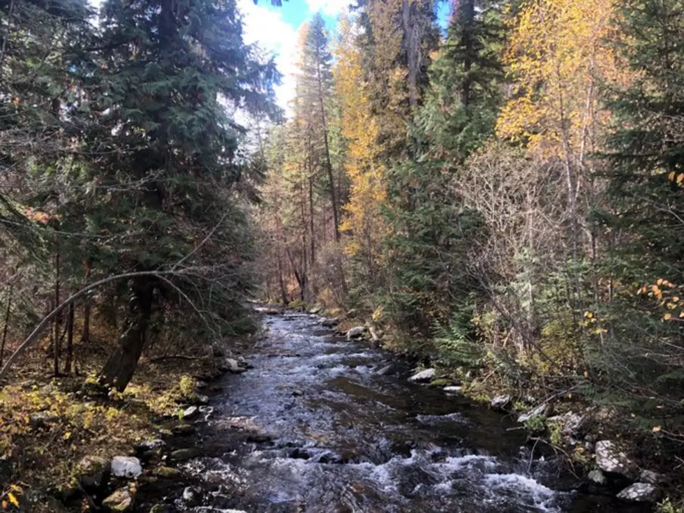
Rock Creek
Rock Creek flows between the Welcome Creek Wilderness Area and many important roadless areas. While we’re pleased the Forest Service has retained recommended Wilderness designation for the main Quigg roadless area, it missed an opportunity to recommend Wilderness for the Stony Mountain roadless area to the west.
The Forest Service should protect all the pieces of the Rock Creek watershed area so the creek can remain a blue-ribbon stream and the area can keep serving as a corridor for elk, mule deer, and other wildlife.
It’s critical the Forest Service hears from you at this early stage of the Lolo Forest plan revision so that the final plan protects wildlife habitat, headwaters, quiet recreation opportunities, and everything else we love about the Forest. For more on how to comment on the plan, visit wildmontana.org/loloplan.
Maddy Munson is the public lands director at Wild Montana.